

Description
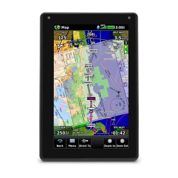
The Garmin Aera 760 is an advanced aviation portable GPS navigator with a bright, durable 7-inch touchscreen display, designed for use as a primary or backup navigation reference in the cockpit. It offers advanced features, including IFR approach capability and 3D terrain display.
Key Specifications
- Physical Dimensions: 18.5 cm (W) x 12.3 cm (H) x 2.3 cm (D).
- Display Size: 7 inches (17.8 cm) diagonal.
- Display Resolution: 480 x 800 pixels, WVGA color TFT with white backlight, usable in both portrait and landscape orientations.
- Weight: Approximately 561 g.
- Battery: Rechargeable lithium-ion, approximately 4 hours with 80% backlight setting.
- Connectivity: Built-in Wi-Fi® for wireless internet database and weather updates, Bluetooth®, and USB-C power/data input.
- Durability: Rugged design built to withstand flight conditions.
Flight Features
- IFR Navigation: Allows pilots to load IFR departure, arrival, and approach (IAP) procedures into the flight plan.
- 3D Vision: Provides a 3D virtual perspective view of surrounding terrain, obstacles, and airports using an internal database and the aircraft’s 3D GPS position.
- WireAware™: Wire collision avoidance technology that displays obstacles and wires along the flight route.
- Wireless Sync: Can be paired with other compatible Garmin devices, such as the Garmin GTX™ 345 transponder or GDL® 52 series datalink, to display ADS-B traffic and weather data.
- Flight Calculations: Includes an E6B Flight Computer and a weight & balance calculator.
- Database: Includes VFR section maps, low/high IFR and helicopter route charts, and georeferenced approach plates (Garmin standard, Jeppesen optional). Database updates can be performed via Wi-Fi.
- PDF Viewer: Allows users to import and view PDF documents via a Micro SD card.

Reviews
There are no reviews yet.